

Demystifying Karachi's bus routes — you don't need to memorise numbers anymore
How the RedBus app's algorithm removes the mental load of route planning, and a primer on how Karachi's Red Bus network is structured.
By RedBus Karachi Team
For decades, Karachi's bus network ran on alphabetic route codes — G-19, W-11, U-87, K-2 — that only a regular commuter could decode. New residents, students from out of town, and anyone visiting the city for a few days had a hard time.
The Red Bus network changed that. Today, Karachi's transit is built around a numbered grid that's much easier to learn. The RedBus Karachi app takes it a step further: you don't even need to learn the grid. Type a destination, and the app does the rest.
The old way: memorise and ask
The old network had two big problems:
- Memorising route codes. Each route was a letter and a number. There was no obvious pattern — a "W" bus didn't always go west, a "G" bus didn't always start in Gulshan. The codes were historical accidents that nobody redesigned.
- Asking strangers for directions. The most common way to learn a route was to ask the conductor, the chai stall owner, or a fellow passenger. Helpful people, but not a scalable learning method.
The new Red Bus network
The Red Bus reorganised Karachi's main corridors into a structured grid. There are two families of routes worth knowing:
The R-Series (numbered red buses)
The standard Red Bus routes are numbered R1 through R13. All routes operate daily from 7:00 AM to 10:00 PM, with a headway of about 15 minutes during peak hours (8–10 AM and 5–8 PM) and about 30 minutes in off-peak hours. The fare is Rs. 80 per person per ride for trips up to 15 km, and Rs. 120 for trips above 15 km.
| Route | Length | Terminals |
|---|---|---|
| R1 | 28 km | Khokrapar to Dockyard |
| R2 | 30 km | Power House to Indus Hospital |
| R3 | 31 km | Power House to Nasir Jump (via Shaan Chowrangi) |
| R4 | 21 km | Power House to Tower |
| R8 | 17 km | Yousuf Goth to Tower |
| R9 | 42 km | Gulshan-e-Hadeed to Tower |
| R10 | 28 km | Numaish Chowrangi to Ibrahim Hyderi |
| R11 | 19 km | Miran Nakka to Shireen Jinnah Colony |
| R12 | 31 km | Naddi Kinara to Lucky Star Saddar (via Khokrapar) |
| R13 | 20 km | Hawksbay to Tower |
The Sindh Government has also introduced Double Decker buses on high-traffic R-series routes to ease congestion. In the first phase, 250 buses are running on seven routes; a second phase will add 110 more buses for a total of ten fully operational R-series routes.
The EV-Series (electric buses)
The newer electric bus routes connect different parts of the metropolitan area. Five EV routes are operational:
| Route | Length | Terminals |
|---|---|---|
| EV1 | 28 km | Malir Cantt to Dolmen Mall Clifton (via Tank Chowk, Karsaz, DHA Phase 1) |
| EV2 | 30 km | Bahria Town to Malir Halt (via Dumba Goth, Baqai University) |
| EV3 | 20 km | Malir Cantt Check Post 5 to Numaish (via Mausamiyat, Johar, Numaish) |
| EV4 | 34 km | Bahria Town to Ayesha Manzil (via Jamali Pull, Al Asif, Sohrab Goth) |
| EV5 | 20 km | DHA City to Sohrab Goth |
EV buses are air-conditioned, electric, and serve longer-distance commuters. For people living in the suburbs (Bahria Town, DHA City, Malir Cantt), the EV network is the most compelling reason to reconsider public transit.
The BRT lines (separate from PBS)
The Sindh Government is also building and operating a separate network of Bus Rapid Transit (BRT) lines:
- Green Line BRT — Surjani to Numaish
- Red Line BRT — Malir Halt to Numaish (under construction)
- Yellow Line BRT — Dawood Chowrangi to Numaish (under construction)
- Karachi Circular Railway — a separate urban rail project
These BRT lines are distinct from PBS but share the same Numaish hub, so transfers between PBS and BRT happen at Numaish.
The grid is small enough that you can roughly learn the corridors in a week of regular riding. Most routes pass through a few major hubs — Numaish, FTC, Saddar, Tower — which become your reference points.
The interchange problem
The grid is simple, but most trips still need a transfer. Going from one neighbourhood to a distant one isn't usually a single bus — it's typically two: a local route to a major hub, then another route to your destination.
The mental load of figuring out the transfer — which bus do I take first, where do I switch, which bus do I take next, and where do I get off — is what stops most people from using public transit at all. Even Karachi's most experienced bus riders pause when they need to go somewhere new.
The solution: Smart End-to-End Routing
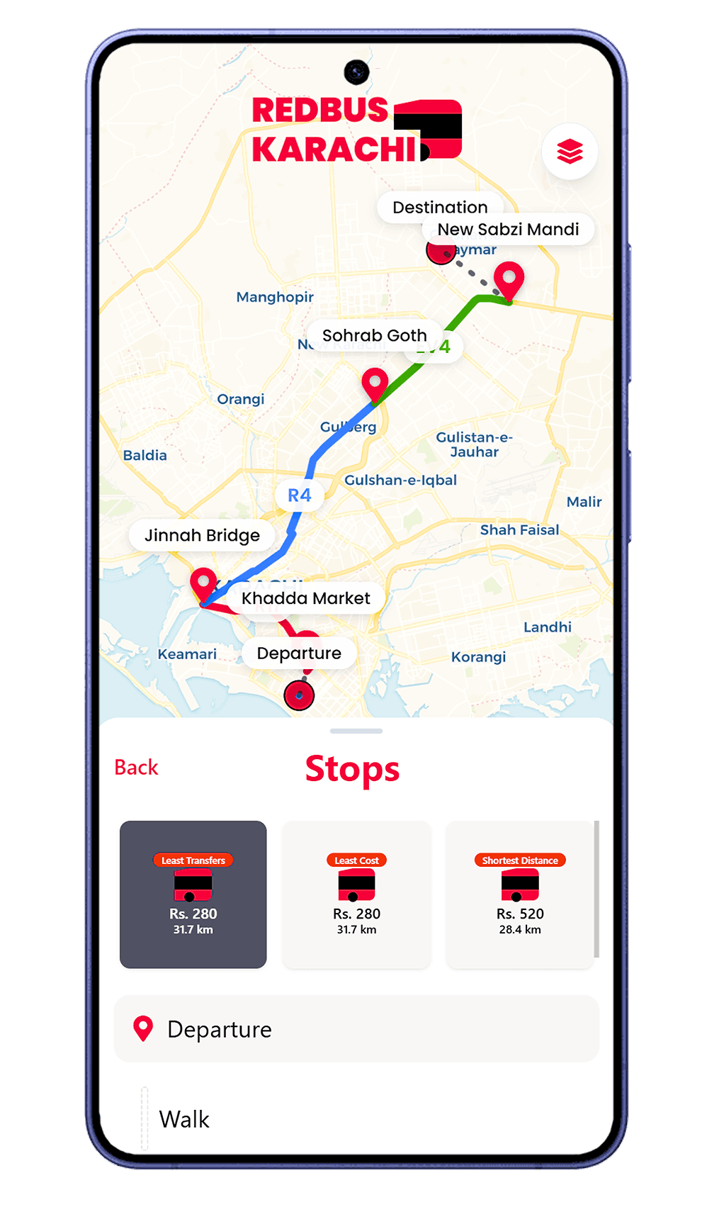
This is what RedBus Karachi's Smart End-to-End Routing was built for. Instead of you memorising the grid, the app models Karachi's bus network as a graph and searches it for you.
When you type a destination, the app:
- Finds the nearest designated stop to your start location.
- Searches the network for the shortest reasonable chain of buses to your destination.
- Lays out the chain step by step: which bus to board first, where to switch, which bus to board next, and where to get off.
- Shows you the fare for each leg so you know the total cost before you leave.
You don't have to know any route numbers. You don't have to know where the interchanges are. The app handles all of it.
Why we built RedBus Karachi: The official PEOPLES BUS SERVICE app frequently glitches, crashes, and shows inaccurate live tracking (per App Store user reviews). We built RedBus Karachi specifically to fix those frustrations — faster, more reliable, and tuned for how Karachi commuters actually plan their trips.
What this means in practice
If you live in Gulshan-e-Iqbal and want to go to a destination in Clifton, you don't need to know which bus to take, where to switch, or where the interchanges are. You just type the destination into the app and follow the chain it gives you.
For a practical first-trip walkthrough, read The ultimate beginner's guide.